News / Jun 02, 2026
The public map around Area 51 just got smaller
Dreamland Resort's 2026 updates show the Area 51 watcher map changing in real time: Tikaboo closed, NTTR boundaries updated, and the remaining public viewpoints pushed farther out.
Dreamland Resort's latest update list reads like a small change log. A boundary file here. A satellite image there. A Tikaboo Peak overlay. A route page rewritten after the closure.
Put together, it says something larger: the public map around Area 51 is getting tighter.
Dreamland Resort is not an official source. It is an old Area 51 watcher archive, online since 1999, with maps, trip reports, Janet notes, scanner material, satellite-image pages, Tikaboo directions, and long-running local context. That makes it useful in a narrow way. It is where the public-facing map changes show up quickly.
In May 2026, several of those changes landed at once.
What changed in May
On May 21, Dreamland Resort updated its Google Earth plug-in for Nevada Test and Training Range ground boundaries.
On May 17, it added a new Area 51 satellite image from April 5, 2026.
On May 4, it added a Google Earth overlay for the newly restricted area around Tikaboo Peak.
On May 1, it updated the Tikaboo Peak directions page to say public access is no longer possible after the March 25 closure.
Those are not dramatic items by themselves. They are map work. But map work matters around Area 51 because access, distance, and sight lines are the story.
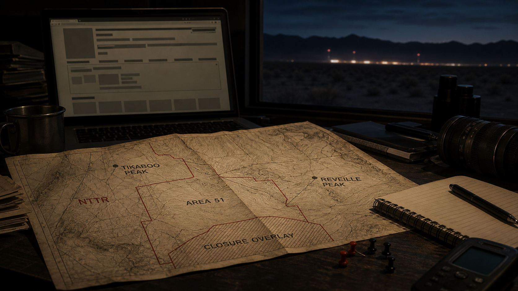
Tikaboo is the hinge
Tikaboo Peak mattered because it was the known public long-lens viewpoint toward Groom Lake after Freedom Ridge and White Sides were closed in 1995.
It was never easy. The Dreamland directions make that plain: remote roads, rough hiking, altitude, no water, little traffic, and serious optics if anyone wanted more than a symbolic view.
Now the page carries a red notice saying Tikaboo Peak and part of the access road are off limits to the public. Dreamland links the notice to the BLM closure order and a closure-area map.
That does not settle the motive. It does settle the practical effect.
The most famous remaining public Area 51 viewpoint is no longer available.
The new map is not cleaner
The obvious next question is where the public view goes next.
Reveille Peak has already entered that conversation. It is farther away, rougher in practical terms, and not a simple replacement for Tikaboo. But it keeps one thing alive: the idea that a legal public line of sight still exists somewhere beyond the closed area.
That is why the Dreamland update list matters. The NTTR boundary file, the Tikaboo closure overlay, the satellite-image page, and the revised directions all point to the same moving target: where public observation ends, where restricted land begins, and what can still be checked from outside.
Area 51 is often treated as a mythology problem. On the ground, it is also a map problem.
The satellite-image piece
The April 5, 2026 satellite-image page is a different kind of update.
It does not open the base. It does not answer the old UFO questions. It gives watchers another public frame to compare: buildings, ramps, roads, visible changes, and what can be seen from above rather than from a mountain.
That matters more after Tikaboo. If the ground view gets worse, satellite imagery becomes a larger part of the public record.
Not a perfect part. A satellite image can miss activity, timing, detail, and context. But it is still a timestamped public view of a place designed to be hard to see.
The useful story
The useful story is not that Dreamland Resort proves some hidden UAP claim.
The useful story is that one of the oldest Area 51 public archives is now tracking a smaller public-access map in real time.
Tikaboo is marked closed. The closure boundary is now an overlay. The NTTR boundary file has been refreshed. New satellite imagery is being logged. Reveille Peak and other distant angles matter more because the old public route matters less.
That is a quieter story than the usual Area 51 folklore.
It is also more durable.
People can argue about what is inside the range. The map outside the range is changing in public.