Main Article / Jul 20, 2026
The Nevada hill that tracked the X-15 has an exact map point
A current desert video leads to concrete foundations north of Beatty, Nevada. A NASA technical note fixes the place exactly: the former High Range Tracking Station that helped keep the X-15 in contact across a 485-mile flight corridor.
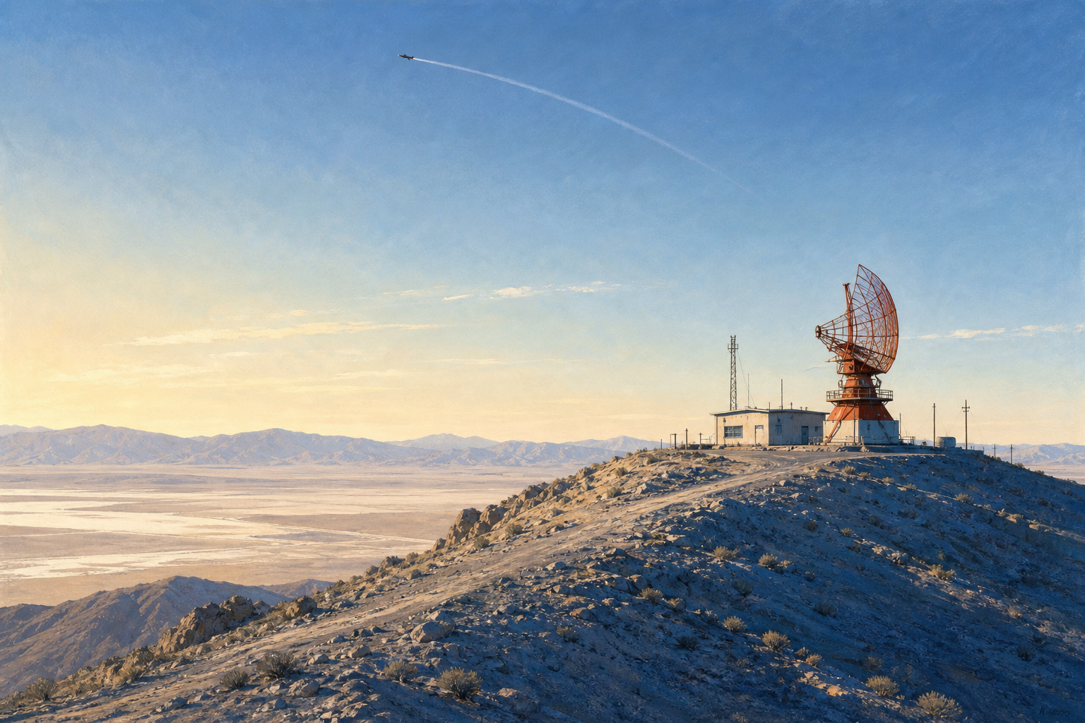
The road north out of Beatty, Nevada, does not announce what once sat above it. In a new field video, a desert traveller follows an old track to a flattened hilltop and finds concrete pads, a few utility traces and a wide view over the basin. Most of the buildings and equipment are gone.
NASA’s record gives the hill a name and a precise point: the Beatty High Range Tracking Station, at 37°04′54.036″ N, 116°49′09.030″ W, 4,964.30 feet above mean sea level. That is about 18 miles north of Beatty on what was then the Tonopah Highway, now U.S. Route 95. The coordinates come from a 1968 NASA technical note, not from a satellite-image guess.
The station did not watch for UFOs. It helped make one of the strangest-looking aircraft in American flight history trackable when it crossed Nevada at hypersonic speed.
A hill with a job
The X-15 was a rocket-powered research aircraft carried aloft by a B-52, released at altitude and accelerated by its own engine. It set speed and altitude records, but its short powered flight and long glide required a bigger support system than Edwards Air Force Base could provide by itself.
NASA and the Air Force built the High Range for that reason. The corridor ran roughly 485 miles from the Utah-Nevada region to Edwards in California and was about 50 miles wide. Its three principal ground stations were at Edwards, Beatty and Ely. Radar, telemetry and voice communications passed between them and the control room, giving engineers and flight controllers overlapping coverage as a vehicle moved downrange.
NASA’s X-15 history describes the Beatty and Ely stations as part of a network that received, recorded and forwarded telemetry and voice traffic to Edwards. The same system could help position the B-52 launch aircraft, follow the research plane and support an emergency landing decision. At Beatty, the work was practical: acquire the aircraft, keep the data moving and preserve a communications link as it passed downrange.
The system was planned early. A 1956 engineering plan called for access roads, shelters, radar, telemetry and communications equipment at the two Nevada sites. Barnes later described the Beatty crew as ten people: a station manager, technical adviser and engineers responsible for the radar, data transmission, communications, telemetry and power plant. His account supplies the personnel detail; the NASA record supplies the wider system.
The exact map point
The most useful document is not a dramatic photograph. It is a table in a 1968 NASA Technical Note about processing High Range flight data. Next to the word “Beatty,” it lists the latitude, longitude and station altitude. Converted only in format, not in meaning, the site is about 37.08168° N, 116.81918° W.
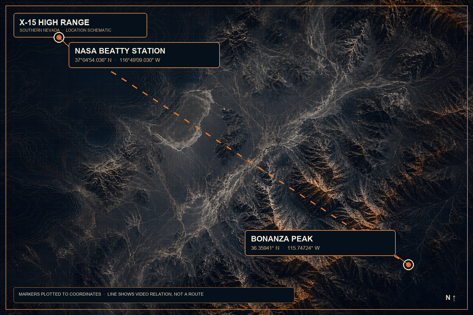
That matters because several nearby places get folded together in online Area 51 geography: Beatty, the Nevada Test and Training Range, the Nevada National Security Site, Yucca Lake and the road toward Las Vegas. They are not one place. The historical station is a specific hill north of Beatty, outside the later stories that tend to pull every desert facility into the same legend.
The point is historical identification, not an invitation to enter land or follow an unverified route. Access, land status and road conditions change; the record establishes where the NASA station was.
What the station tracked
Its main purpose was the X-15 programme. Former contractor Thornton D. Barnes, who worked at Beatty in the 1960s, also recalled support for XB-70 Valkyrie flights, lifting bodies and lunar-landing research vehicles. Barnes later wrote that the station was used on some A-12, YF-12 and SR-71-related flights. That last part is a participant’s account, not a NASA programme history, and belongs to the story as attribution rather than proof of every operation claimed for the site.
The broad picture is not in doubt. The Smithsonian describes the X-15 corridor as the High Range and notes that it was monitored from stations at Ely and Beatty. NASA’s own histories place the corridor between Edwards and Wendover, with radar and telemetry stations in both Nevada towns.
The physical station did not survive intact. The hilltop foundations in the video are consistent with an installation whose radar, telemetry and communications equipment had long since been removed. What remains is the ground plan of a site built to follow an aircraft moving faster than the horizon.
Why the current video heads south
The video uses the Beatty stop as the first half of a much newer Nevada test-range story. From there, its creator crosses the public highway corridor, then hikes Bonanza Peak in the Spring Mountains. The summit is publicly mapped at 36.35941° N, 115.74724° W, about 10,380 feet above sea level.
From that distant viewpoint, the video looks toward Yucca Lake and the facility commonly called Area 6. The public record is narrower than the online mythology. A Department of Energy contractor report from 2008 describes an Aerial Operations Facility on the southeast side of Yucca Lake in Area 6, built to construct, operate and test unmanned aerial vehicles, including airframe modifications, sensors and onboard-computer work. A current Nevada National Security Site environmental report still identifies a “Yucca Lake Airfield” in Area 6.
That does not identify current programmes, contractors or aircraft. It does establish why the broader landscape continues to attract aviation-watchers: old public NASA infrastructure, restricted test airspace, and a patchwork of official records with very different levels of detail.
What remains on the hill
The video’s most solid discovery is an abandoned site whose coordinates and purpose are in the NASA record. It was part of the machinery that made the X-15 era possible.
At Beatty, the old pad still looks out across the basin. NASA’s station table supplies the name, the coordinate and the elevation. The radar, instrumentation and people who worked there have gone; the foundations remain.
Related UAP Logbook reading
- Area 52 was a name in a phone book before it was a meme
- Area 51 is a test range, not a single mystery
- What is Tikaboo Peak?
- The Foo Fighters and the 415th Night Fighter Squadron
Sources
- NASA Technical Note: High Range station data — Beatty coordinate and altitude.
- NASA Technical Publication: Aerodynamic Test Range Facilities Handbook — 1956 engineering plan for the Beatty and Ely sites.
- NASA: X-15 Hypersonic Research Program.
- NASA History: The X-15 Hypersonic Flight Research Program — High Range corridor and its tracking stations.
- TopoZone: Bonanza Peak, Nevada — published summit coordinate used in the location schematic.
- Smithsonian: North American X-15 — Ely and Beatty monitoring the High Range.
- Thornton D. Barnes: NASA X-15 Program — former contractor’s account of the Beatty station and other flights; used here as attributed recollection.
- Department of Energy contractor report: Aerial Operations Facility, Area 6.
- Nevada National Security Site Environmental Report 2023 — Yucca Lake Airfield reference.
- Source video — public field footage and narration; treated as a lead, not authority for site history or current facility claims.